Most plants grow on land, in the band between the tropics and the temperate zones, where liquid water, moderate temperatures, and sunlight all overlap for enough of the year to support photosynthesis. That's the short answer. The longer, more useful answer is that plant distribution is controlled by five interlocking factors: climate zone, light availability, water and humidity, soil chemistry, and the plant's own evolutionary history. Once you understand how those five levers work together, you can look at almost any plant and figure out whether it belongs in your location or not.
Where Do Most Plants Grow and How to Predict Where They Can Grow

Dr. Marcus Weatherby
18 Apr 2026
Global overview: where most plants grow on Earth
The vast majority of Earth's plant species are concentrated in tropical and subtropical regions, particularly in tropical rainforests. These areas combine year-round warmth, consistent rainfall, and intense sunlight in ways that let plants run their growth engines at full throttle. The Amazon Basin, the Congo Basin, and the forests of Southeast Asia together hold an enormous share of the world's plant diversity. Forests in general dominate: an IUCN-backed sampled assessment found that 79% of threatened plant species occupy forest habitats, which gives you a sense of just how plant-dense those ecosystems are compared to other biomes.
Moving away from the tropics, plant abundance and diversity taper off with latitude and altitude. Temperate zones still support rich plant communities, but the growing season shrinks as winters lengthen. Boreal forests and tundra mark the upper edge of where vascular plants can hold on in meaningful numbers. Aquatic and freshwater environments are a separate story: freshwater habitats cover only about 2% of Earth's surface, yet they are remarkable biodiversity hotspots, supporting a specialized set of aquatic and semi-aquatic plant communities. Deserts and polar regions exist at the other extreme, where conditions filter out everything except highly specialized survivors. The global pattern, then, is a gradient from richest (warm, wet, bright tropics) to sparsest (cold, dry, or dark extremes).
Climate and sunlight: how temperature and light shape plant distribution
Temperature is the single most powerful filter on where plants can live. The USDA Plant Hardiness Zone Map translates this into a practical number: zones 1 through 13, each representing a 10°F band in average annual extreme minimum winter temperature. The map is built on 30 years of historical weather data, so it reflects long-term patterns rather than one brutal cold snap. If a plant is rated for Zone 7 and you garden in Zone 5, the math is simple: your winters are likely to kill it. You can look up your zone by zip code on the USDA's interactive map, which is a good first step for any unfamiliar plant.
The hardiness zone tells you about winter survival, but it doesn't tell you whether a plant can complete its growth cycle in your summer. For that, growers use Growing Degree Days (GDD), a system that accumulates heat units above a base temperature threshold during the growing season. Below that base temperature, plant growth is effectively zero. Tools like the USDA AgroClimate GDD Calculator let you plug in your location and see whether your season delivers enough accumulated warmth for a given crop or plant. A pepper variety that needs 2,000 GDD won't mature in a short northern summer even if it technically survives the winter.
Light adds another dimension. Day length, called photoperiod, controls whether many plants flower at all. Short-day plants (which are really long-night plants) flower when darkness exceeds a critical threshold, making them bloom in late summer or autumn. Long-day plants do the opposite, flowering in late spring and early summer.
Some plants are day-length neutral and respond primarily to temperature. This matters for distribution because photoperiod is latitude-dependent: a short-day plant moved too far north will experience nights that never get long enough during its natural flowering window, and it simply won't bloom. Microclimates further complicate the picture.
The USDA explicitly notes that microclimates can be too small to appear on any zone map, so a sheltered south-facing wall in Zone 6 might behave like Zone 7, while a frost pocket at the bottom of a slope might act like Zone 5.
Water, humidity, and seasons: deserts, tropics, tundra, and wetlands
Water availability is the second major axis of plant distribution, and it interacts with temperature in ways that define every major biome. Tropical rainforests receive more than 2,000mm of rainfall annually with no real dry season, which is why they sustain towering canopies and multi-layered understories. Mediterranean climates get most of their rain in winter and bake through summer, selecting for drought-tolerant shrubs and bulbs that go dormant when it's hot and dry.
Deserts receive less than 250mm per year, and their plant communities are built around water storage, deep roots, or rapid ephemeral life cycles. Tundra receives little precipitation too, but the limiting factor is actually temperature and permafrost rather than rainfall per se: water exists but is locked in ice much of the year, and the growing season may be only 6 to 10 weeks long.
Wetlands occupy the other extreme, and they present a different kind of challenge. Waterlogged soils are oxygen-depleted, and most plants cannot handle that. When fine roots sit in saturated soil, oxygen availability collapses, root cells die, and the plant loses its ability to take up water even though it's surrounded by it. The result looks like drought stress from the outside: wilting, leaf scorch, and decline.
Wetland plants have structural adaptations like aerenchyma (air channels in stems and roots) that allow them to function where others drown. If you're near a wetland margin, that's your shortlist of candidates. For freshwater habitats specifically, plant distribution is strongly shaped by catchment characteristics, meaning the drainage basin's geology, slope, and land use all filter which species show up in a given water body or its margins.
Seasonality matters as much as annual totals. A plant that evolved in a monsoon climate expects a long dry period followed by intense wet. Move it somewhere with evenly distributed rainfall and the timing mismatch can prevent dormancy or flowering. Understanding whether your location has a distinct wet season, a cold dormancy period, or year-round moisture is more useful than knowing the annual rainfall figure alone.
Soil and terrain: soil type, nutrients, salinity, and elevation limits
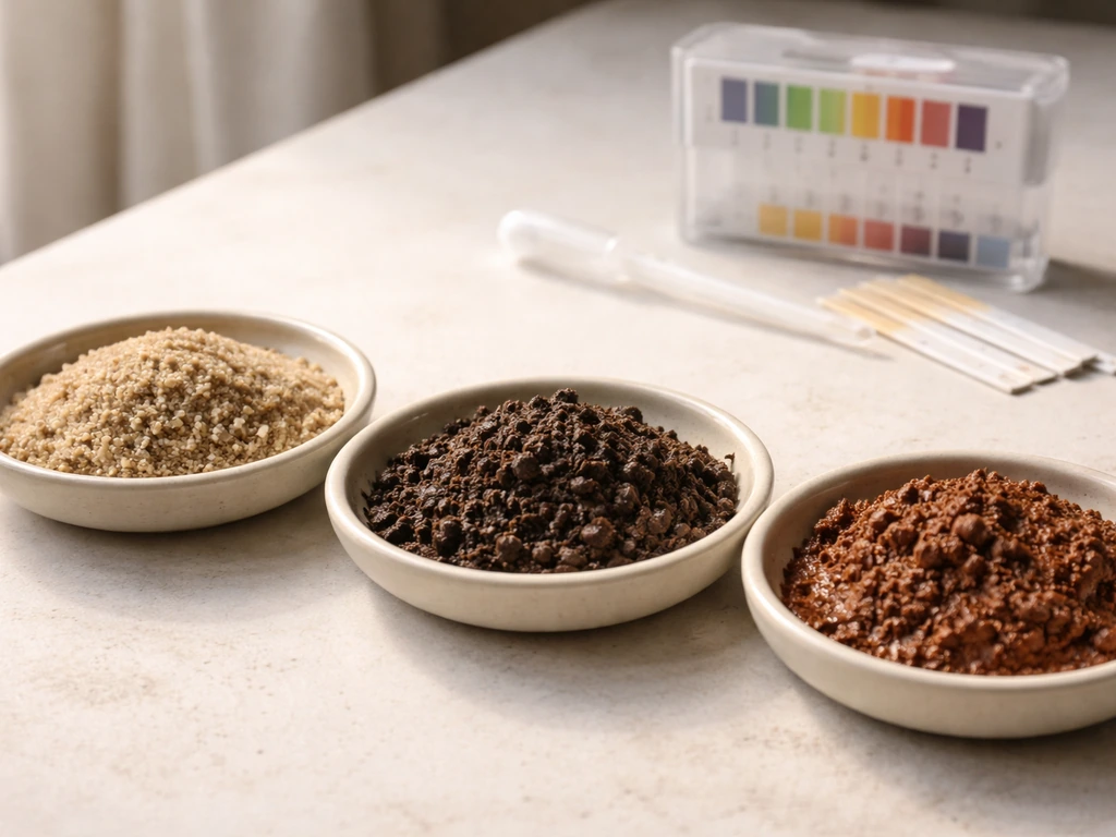
Soil is where many plant distribution questions get answered in the field. The most critical soil variable for nutrient availability is pH. Mississippi State University Extension notes that micronutrient availability is influenced by soil pH, and higher pH can reduce bioavailability for micronutrients such as boron, iron, zinc, and manganese [Most garden plants and agricultural species do best in the 6. ](https://www.
extension. msstate. edu/publications/micronutrients-mississippi-soils-and-plant-nutrition). Most garden plants and agricultural species do best in the 6.
0 to 7. 5 pH range, where nutrients are most soluble and accessible. Below pH 5. 5, aluminum, iron, and manganese become highly soluble and can reach toxic levels that damage roots directly.
Above pH 7. 5, micronutrients like iron, zinc, and manganese become insoluble and unavailable, causing deficiency symptoms even when the elements are physically present in the soil. Acid-loving plants like blueberries and rhododendrons are exceptions: they evolved in soils where that low pH is normal and actually suppress competing species.
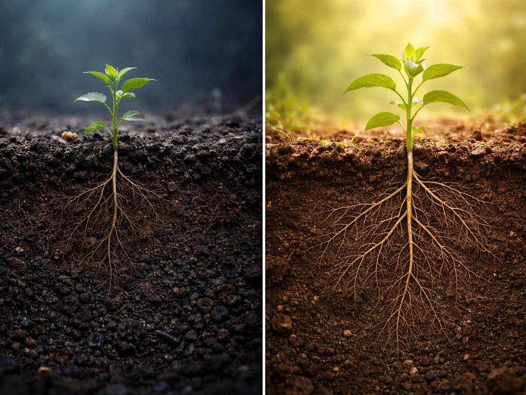
Cation exchange capacity (CEC) is the soil's ability to hold nutrient cations on particle surfaces and release them to roots. Clay-rich soils have high CEC and hold nutrients well. Sandy soils have low CEC and depend heavily on organic matter for any nutrient retention at all. A plant that evolved in a rich clay loam will struggle in a sandy coastal soil not because the sand is inherently hostile but because it can't hold the nutrient load that plant expects. This is why matching soil texture and organic matter content to a plant's native soil conditions matters as much as matching pH.
Elevation adds a vertical dimension to all of this. As you go up, temperatures drop (roughly 3°F per 1,000 feet), UV radiation increases, wind intensifies, and soils tend to become shallower and more skeletal. A plant common at 500m may simply not occur at 1,500m in the same mountain range, not because the soil chemistry changed, but because the temperature and wind load crossed a threshold. Salt is a similar hard limit in coastal and arid environments: salinity in soil water raises osmotic pressure, making it thermodynamically harder for roots to pull in water. Coastal salt marsh plants like cordgrass have evolved to handle this; most inland species have not.
Natural range: native habitats and how to infer where a plant comes from
When someone asks "where do plants grow from," they're usually asking about native range: the geographic area where a species evolved and still naturally occurs without human introduction. A plant's native range is the best predictor of what conditions it actually needs, because natural selection shaped it to perform in that environment. A plant from the South African fynbos evolved for dry summers, sandy acidic soils, and periodic fire. Replant it in a humid clay garden in the Pacific Northwest and you're asking it to tolerate conditions it never encountered in its evolutionary history.
The most practical tool for finding native range data today is the Global Biodiversity Information Facility (GBIF), which aggregates occurrence records from herbarium specimens, field surveys, and human observations into a searchable database. GBIF records include the basis of each record (specimen, observation, etc.
In a GBIF community forum discussion, the “Occurrence” basis of record is described as a general or catch-all used when more specific basis-of-record metadata (such as observation versus specimen) is not available basis of each record (specimen, observation. ) and spatial accuracy information, which matters because not all records are equally reliable.
For any unfamiliar plant, pulling up its GBIF occurrence map will show you the actual documented locations, which you can then cross-reference with climate zone maps to extract the environmental envelope the plant naturally occupies. This approach is more reliable than reading a vague "native to tropical regions" description in a catalog.
Native range also helps with seasonality. A plant native to the Southern Hemisphere has growth and dormancy cycles tied to the opposite calendar. Moved north of the equator, it may flower at the wrong season, miss its pollinator window, or break dormancy during the wrong temperature phase. This is a common reason why plants that look climatically matched on paper still underperform in practice.
Where plants don't grow: the hard limits
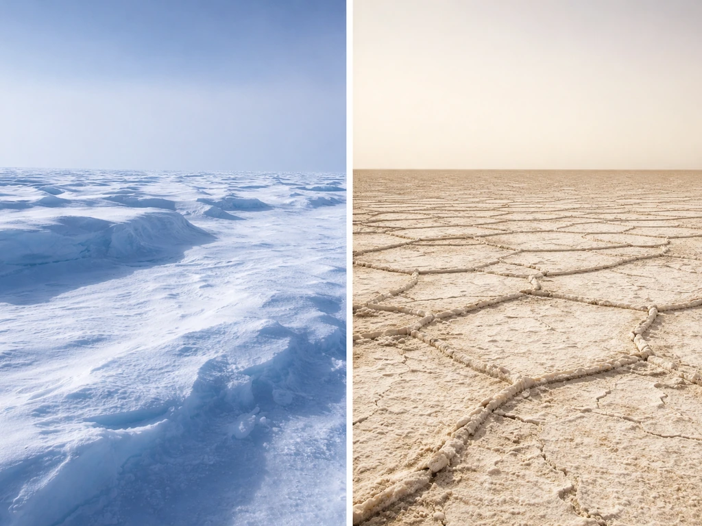
Understanding where plants don't grow is just as useful as knowing where they do. The clearest no-grow zones on Earth are the deep polar ice sheets, where liquid water is essentially absent year-round and light is missing for months at a time. Beyond the poles, extreme high-altitude zones above the alpine treeline exclude most vascular plants not because of cold alone but because the combination of cold, thin soil, high UV, and desiccating wind creates a stress cocktail nothing has adapted to handle at scale. A few cushion plants and mosses push into those zones, but they represent the outer margin of plant life, not a functional plant community.
Hyper-arid deserts like the Atacama in its driest core, where rainfall can be effectively zero for years, exclude most plant life for obvious reasons. Highly saline soils, whether coastal, alkaline playas, or salt-affected agricultural land, exclude all but halophytes. Waterlogged anaerobic soils exclude everything except wetland specialists. And human-modified conditions create new no-grow zones that don't appear on natural maps: compacted soils with no pore space for roots or air, heavily contaminated brownfield soils with metal toxicity, and impervious surfaces are all effectively sterile for plant growth. Knowing that your site falls into one of these categories is often more useful than knowing what zone you're in, because the constraint is a fixed wall rather than a sliding scale.
It's worth noting that some plant groups are defined by the unusual places they do manage to grow. Carnivorous plants, for instance, colonize nutrient-poor boggy soils that most species can't tolerate, turning the constraint into a competitive advantage. Non-vascular plants like mosses push into areas where vascular plants fail because they don't depend on root systems or conductive tissue.
If you're wondering where non vascular plants grow, mosses are a good example of how they thrive in damp, nutrient-poor habitats where vascular plants struggle Non-vascular plants like mosses. The edge cases are fascinating, but for most gardeners and land managers, the practical takeaway is: if your site has one of the hard limiting conditions listed above, you need to fix the condition first or select a specialist, not just find a tougher cultivar.
Insectivorous plants generally grow in which area, which is another useful example of how habitat constraints shape where certain groups can survive.
How to find the right plants for your place
The most reliable method is to work through five decision points in order. Each one narrows the field, and by the time you've gone through all five, you typically have a short list of viable candidates rather than an overwhelming catalog of possibilities. If you are trying to grow a specialist like carnivorous plants, narrowing that short list based on “where do carnivorous plants grow” helps you match the right habitat and moisture conditions short list of viable candidates.
- Find your hardiness zone. Use the USDA Plant Hardiness Zone Map with your zip code. This tells you the minimum winter temperature your site is likely to experience, which eliminates any plant not rated for your zone or colder. If you use Sunset Climate Zones (which also account for latitude, summer heat, and other factors beyond winter cold), you get a more nuanced year-round picture, especially in the western United States.
- Check your growing season length and heat accumulation. Look up your average last and first frost dates, then calculate or look up typical GDD for your area using a tool like the USDA AgroClimate GDD Calculator. Match this to the GDD requirement for the plant in question. If your season doesn't deliver enough heat units, the plant won't complete its cycle regardless of hardiness.
- Assess water availability and seasonality. Know your annual rainfall, but more importantly know when it falls. Does your site have a dry summer, a wet winter, or even distribution? Is the site well-drained, seasonally wet, or near a permanent water source? Match these patterns to the plant's native climate, not just the annual total.
- Test or know your soil. At minimum, know your soil pH. A simple home test kit or county extension soil test will give you pH and basic nutrient status. For anything native to acidic forest soils, boggy peat, or alkaline prairies, a pH mismatch will cause chronic problems that fertilizer alone can't fix. Also note soil texture: sandy, clay, loam, or rocky skeletal soils each behave differently for nutrient and water retention.
- Look up the plant's native range. Use GBIF occurrence data or a regional flora to see where the species actually grows in the wild. Extract the climate envelope from those locations: what USDA zones do they fall in, what is the rainfall pattern, what soil types dominate. That envelope is your target. If your site sits inside it, the plant is a realistic candidate. If your site sits outside it on multiple axes, expect problems.
A comparison of the two most widely used climate classification tools for plant selection in North America can help you decide which one to start with:
| Factor | USDA Hardiness Zone Map | Sunset Climate Zones |
|---|---|---|
| Primary variable | Average annual extreme minimum winter temperature | Multiple: temperature, latitude, summer heat, humidity, wind, precipitation pattern |
| Number of zones | 13 zones (in 10°F increments) | 45 zones (covering the US and parts of Canada) |
| Best for | Determining winter cold survival | Predicting year-round plant performance and suitability |
| Geographic coverage | US, Canada, and partly beyond | Primarily western and southern US (most detailed there) |
| Microclimate detail | Limited; USDA notes microclimates may not appear | More granular in coastal/mountain areas of the West |
| How to use it | Look up by zip code on USDA website | Look up by location on Sunset's zone finder |
The USDA zone is the right starting point for most of North America, especially if winter cold is your main risk. Sunset zones are worth checking if you're in California, the Pacific Northwest, or the Southwest, where summer heat patterns and coastal fog create climate distinctions that the USDA map flattens out. For anyone outside North America, equivalents like the RHS hardiness ratings in the UK or the Koeppen climate classification system serve similar roles.
One practical shortcut that experienced gardeners use: find what's growing in similar natural habitats near you. Walk a local forest edge, a roadside ditch, a coastal bluff, or a prairie remnant and note what's thriving with zero intervention. Those species have already passed the climate, soil, and water tests for your location. They're not always the most exciting plants, but they are real-world proof of concept. From there, you can branch out to species that occupy ecologically similar niches in other parts of the world, knowing the baseline conditions those species need to perform.
Finally, don't overlook the value of understanding specialized plant groups as reference points. Ferns cluster in humid, shaded environments with consistent moisture. In general, fern plants are most likely to grow in humid, shaded places with consistently available moisture where are fern plants most likely to grow. Rubber plants in their wild form grow in tropical lowland rainforests with high rainfall and warm temperatures year-round. If you recognize that your site shares those conditions, you've identified a whole ecological guild of candidates, not just a single species. Plant ecology works in guilds, and once you know what guild fits your site, the selection process becomes much more intuitive.
FAQ
Where do most plants grow, and why isn’t it the same everywhere with the same latitude?
Most plants grow in warm, bright, and reliably wet or seasonally wet regions, especially within the tropics and subtropics. But the exact “where” can shift because microclimates (sheltered walls, valley cold air pooling, coastal fog) can make local conditions act like a different zone for light, winter lows, or humidity even when the latitude is the same.
Do most plants grow in forests, or are grasslands and wetlands just as important?
Forests dominate overall plant diversity, but grasslands and wetlands also support many species because they create consistent habitat niches, like grazing-tuned roots in grasslands or oxygen-managed root adaptations in wetlands. A site can be low diversity in one group and high diversity in another depending on the limiting factor (waterlogging, salinity, or nutrient availability).
If I know the USDA hardiness zone, can I assume the plant will do well?
Not by itself. Hardiness zones focus on surviving winter cold, not whether you get enough heat for flowering or enough summer water for growth. To avoid disappointment, also check Growing Degree Days (GDD) or the plant’s maturity time, especially for fruiting and annual-style crops.
Why do some plants survive winter in my zone but fail to grow or flower later?
Common reasons include insufficient accumulated warmth (GDD too low), mismatched photoperiod (short-day or long-day triggers not met), and soil oxygen problems (waterlogged soil that looks “wet” rather than “cold”). Even if winter survival works, those other constraints can still stop a full life cycle.
How can I estimate photoperiod problems without special tools?
Start with the plant’s flowering habit (short-day, long-day, day-neutral) and then check whether your latitude is far outside the plant’s native range. Day-length can change enough that a plant will keep vegetative growth or delay flowering, so a simple “it survived” test can still be misleading.
Are freshwater plants determined more by rainfall or by drainage basin characteristics?
By drainage basin characteristics. Geology, slope, erosion, upstream land use, and how water drains into the system often matter as much or more than local rainfall totals. Two lakes at the same latitude can support very different plant communities because one has nutrient-rich runoff or different water chemistry.
Can soil pH be the only soil issue that prevents growth?
It’s often a major blocker, but not the only one. A plant can be in the right pH range yet still struggle due to poor cation exchange capacity (sandy soils without organic matter), compaction that reduces root aeration, or high salts that raise osmotic stress. Best practice is to check pH and also salinity and texture/organic matter.
What happens if my soil pH is slightly “wrong,” like 5.8 instead of 6.0?
Many plants tolerate small deviations, but the risk increases when you cross thresholds where nutrient solubility and toxicity change (for example, below about 5.5 for certain metal mobilization, or above about 7.5 for micronutrient lockout). The best way to confirm is to compare your target plant’s tolerance range plus local test results for iron, manganese, and overall fertility.
If a plant is native to a place with different seasons, will it always fail?
Not always, but it often underperforms because dormancy and flowering cues are tied to seasonal timing, not just temperature averages. A common edge case is plants from the opposite hemisphere, which may break dormancy too early or miss the bloom window, affecting pollination even when climate “looks” suitable.
How do elevation changes alter where plants can grow compared with latitude?
Elevation shifts temperature and exposure more strongly than it shifts latitude. As you climb, cooler temperatures, higher UV, and stronger wind can push plants past their physiological thresholds even if the soil looks similar. This is why a species at mid-elevation may be absent higher up in the same mountain region.
Why do some plants thrive near wetlands but die in “muddy” gardens?
Wetland plants are adapted to saturated, low-oxygen soils, usually with specialized tissues that transport oxygen internally. In gardens, waterlogged soil can become lethal for non-adapted plants because roots suffocate. If you’re not growing a wetland specialist, improving aeration and preventing prolonged saturation is usually the real fix.
What are the most common human-created “no-grow” zones people overlook?
Compacted soils (low pore space), impervious surfaces, and contaminated brownfield soils (metal or chemical toxicity) can act like hard barriers that zone maps do not predict. If a plant “should” grow but keeps failing despite correct watering, soil structure and contamination testing can be the missing step.
If my goal is to match plants to my location, what’s a quick decision checklist?
Start with native range or documented occurrence locations, then filter by winter cold (hardiness), then by growing season heat (GDD or maturity days), then by water pattern (wet season timing vs dry season), and finally by soil pH and drainage/oxygen. If you fix only one factor, it’s usually not enough when the limitation is a hard “wrong habitat” condition.
Are there plant groups that naturally grow where most plants cannot?
Yes. Carnivorous plants often occupy nutrient-poor, boggy conditions where competitors lose out, and mosses (non-vascular plants) can occupy damp sites where vascular plants struggle with rooting or stress. If your site has a hard limiting constraint, selecting a specialist plant group is more reliable than searching for a tougher cultivar of a mainstream species.